You see “Gulf access” on a Bonita Springs listing and imagine sunrise runs to open water. But not every route to the Gulf is the same. Bridge heights, channel depth, no‑wake zones, and distance can change how you use your boat and how long it takes to reach the Gulf. In this guide, you’ll learn what “Gulf access” actually means here, how local waterways work, and how to match a property to your boat and lifestyle. Let’s dive in.
Gulf access, defined for Bonita Springs
Direct vs. indirect access
Direct Gulf access means you have a navigable path from your dock to the Gulf of Mexico without passing under low fixed bridges, through locks, or other permanent height limits that would stop your vessel. You also tend to have shorter travel times and fewer constraints.
Indirect Gulf access means you can still reach the Gulf, but you will go through tidal rivers or canals, likely pass under one or more bridges, and travel longer distances in estuarine channels. Many powerboats handle this easily, but tall-mast sailboats or larger yachts may not fit under fixed spans.
Deep water vs. shallow or no‑wake areas
“Deep water” describes channel depth suitable for larger drafts. “Shallow” or “no‑wake” areas describe speed restrictions or shallower water, which are separate from directness. A home can offer direct access but still require careful attention to depth and speed zones.
Distance and time to the Gulf
Two routes can both be “Gulf access” but feel very different. Your actual time to open water depends on bridge openings, posted speed zones, wind and tide, channel width, and how exposed the route is to bay chop. Always evaluate the full route, not just the label.
How local waterways connect
Bonita Springs waterfronts connect to the Gulf by way of Estero Bay and the Imperial River system. Waterfront options range from beachfront to bayfront, riverfront, and canal-front.
Typical routes to the Gulf
From canal and river lots, you generally follow the Imperial River or local canals into Estero Bay, then continue through a nearby pass to the Gulf. Bayfront owners enjoy quicker, more open water routes before heading out. Beachfront owners have immediate Gulf frontage, but long‑term dockage is limited in surf zones.
What to confirm for any lot
- Whether seasonal shoaling has affected channels along the route, and if dredging is planned or recent.
- Marked channel locations and navigation aids.
- Presence and condition of any private or community ramps.
- Marina options for fuel, guest dockage, or service.
- Realistic transit time to the Gulf at your typical cruising speed.
Bridges and clearances you must verify
Bridges can be fixed high, fixed low, or movable. Fixed low bridges are often the limiting factor for sailboats and taller motor yachts. Movable bridges can solve height issues, but they may have schedules or require a call.
Vertical clearance is the height under a bridge, usually measured at a tidal reference such as mean high water. For masted vessels, the key number is your air draft compared to clearance at high water. Horizontal clearance and channel width also matter for larger beams and two‑way traffic.
To confirm clearances and operations, use:
- Official nautical charts that show published depths and bridge clearances.
- Local notices that report temporary changes, closures, or restrictions.
- State or county bridge data for fixed vertical clearances and opening times.
- Local public works or waterways pages for city and county rules.
- Firsthand knowledge from local marinas, harbor masters, or experienced captains.
- On‑site verification to measure your vessel’s air draft and compare it with clearance at mean high water.
Practical buyer tips
- Do not rely only on a listing’s “Gulf access” note. Verify every bridge on the route and the tidal datum used for the posted clearance.
- If you see a fixed span on the route, confirm whether the height is listed at mean low or mean high water and estimate the clearance on the highest local tides.
- Consider hiring a local captain to run the full route before you close.
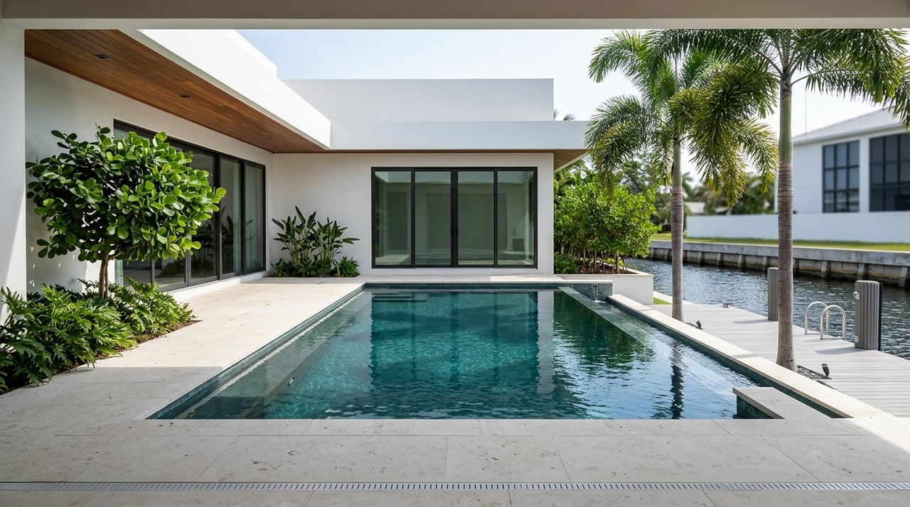
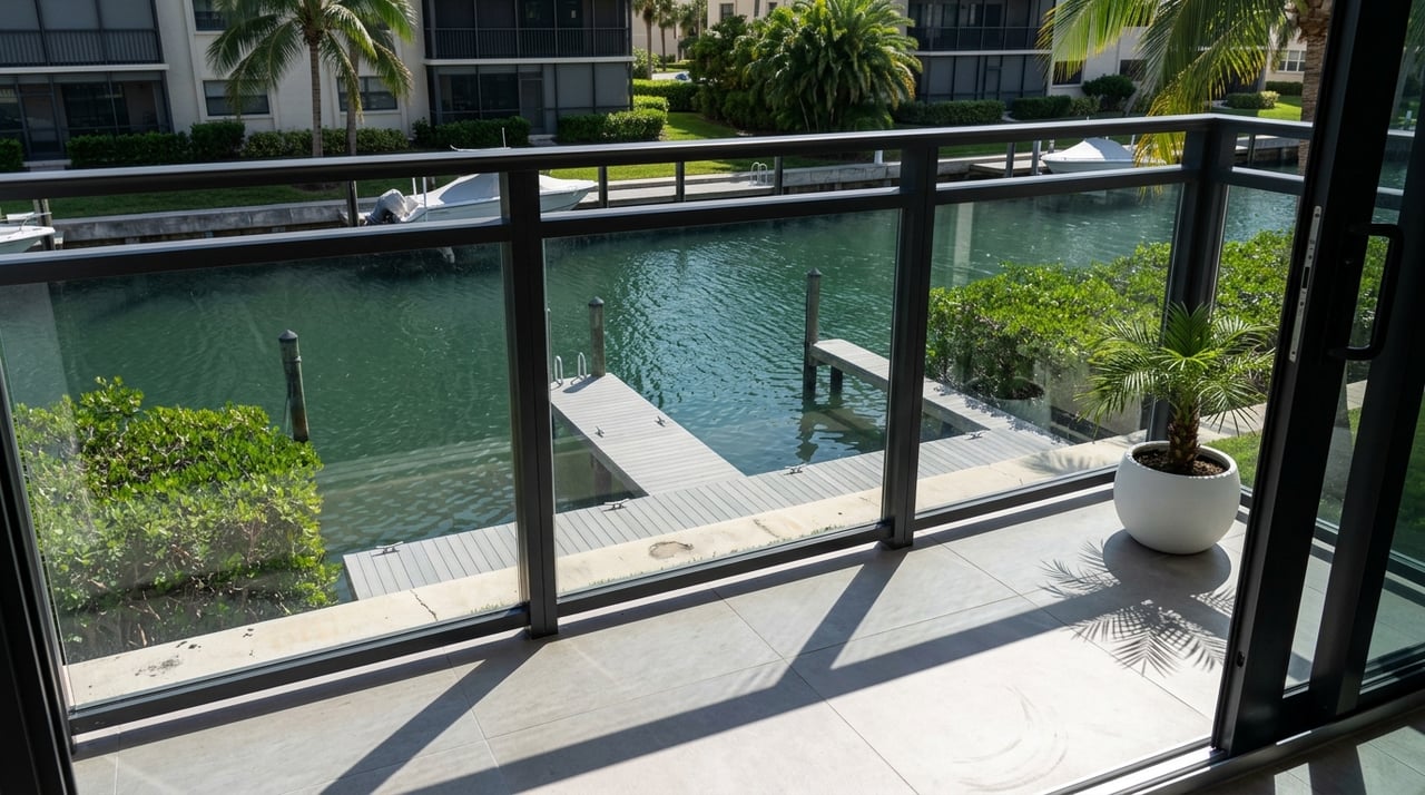
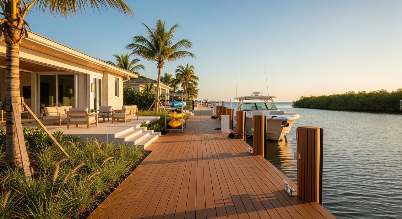
Canal vs. bay vs. beachfront access
Canalfront pros and cons
Canalfront living is quiet and protected, with easy backyard boating for skiffs, flats boats, kayaks, and smaller center consoles. You often have private docks or lifts and a calm place to tie up. The tradeoffs can include shallower depths, narrower channels, frequent no‑wake zones, possible low bridges, and longer travel to the Gulf.
Also ask who maintains the canal. Some canals are privately managed or require community assessments for dredging. Verify responsibility and recent dredging history, since it affects both cost and usability.
Bayfront pros and cons
Bayfront properties on Estero Bay or connected waters offer larger water areas, quicker runs to nearby passes, and more maneuvering room for mid‑size and larger powerboats. You may enjoy deeper water in marked channels and less time idling. The tradeoffs are more exposure to wind and wake and the need for robust dock structures.
Beachfront considerations
Beachfront owners have instant Gulf frontage with direct access for small, beachable craft. Long‑term dockage in surf zones is limited, and you will navigate coastal regulations, dune protections, and setback rules. Many owners combine beach access with nearby marina dockage for larger boats.
No‑wake zones and local controls
Boating rules are enforced by state authorities, local governments, and federal agencies. In Bonita Springs and Lee County, you should expect idle speed or no‑wake zones in narrow residential canals, around docks and marinas, near swimming areas, and within marked wildlife protection zones.
No‑wake designations extend transit times and limit high‑speed runs from certain lots. Some insurance and marina policies also consider speed zones when evaluating risk. Before you buy, confirm local no‑wake maps, where signs are posted, and typical enforcement practices.
Match your boat and lifestyle to the property
Start with the numbers that matter for your vessel and route. Gather:
- Length overall and beam for slip fit and turning.
- Draft and the minimum channel depth you need at mean low water.
- Air draft and the bridge clearance you require at mean high water.
- Typical cruising speed and your acceptable time to the Gulf.
Showing-day checklist
- Confirm the controlling channel depth at mean low water and ask for the last dredge date.
- List every bridge or overhead line on the route and note the published clearance and tidal datum.
- Identify all no‑wake zones, marked channels, and tight turns or bottlenecks.
- Ask the seller or HOA who pays for dredging and whether surveys or assessments are planned.
- Call a nearby marina for current conditions, including shoaling and seasonal wind patterns.
Example pairings
- Small skiff, flats boat, or kayak: canalfront, riverfront, and bayfront can all work. Canalfront is often ideal for protection and convenience.
- Center‑console day boat: bayfront or riverfront usually provides quicker Gulf access; some canals work if depth and width are sufficient.
- Sailboat with a tall mast: look for routes without low fixed bridges or with movable bridges that open on schedule.
- Large motor yacht: target deepwater routes, wider channels, and minimal vertical obstructions, often bayfront or near a pass with suitable marina support.
Lifestyle considerations
If you plan frequent offshore fishing or quick beach runs, you will value shorter, less restricted routes to nearby passes. If you prefer quiet waterfront living, easy docking, and protected water for daily use, a canal setting can be a great fit even with a longer run to the Gulf. Factor in access to fuel, service, haul‑out, and guest dockage to complete the picture.
Smart next steps before you buy
- Pull official charts for channel depths, obstructions, and bridges along your intended route.
- Check recent navigation notices for temporary changes or construction.
- Review state or county bridge tables for posted vertical clearances and any opening schedules.
- Visit local public works or waterways pages for dredging programs, speed zones, and marina info.
- Speak with marina managers, harbor masters, or tow captains for on‑the‑water reality.
- Hire a local marine surveyor and consider a licensed captain to run the route you intend to use.
- Request documents in the transaction: recent hydrographic surveys, dredging history or plans, HOA boating rules and assessments, bridge clearance documentation, and any dock or lift permits.
Choosing a Bonita Springs waterfront home is about more than a “Gulf access” label. When you align bridge clearance, depth, speed zones, and distance with the boat you own and the way you want to use it, you set yourself up for effortless days on the water. If you want a thoughtful, concierge approach to pairing the right property with your boating goals, connect with Naples Bonita Luxury Homes.
FAQs
What does direct Gulf access mean in Bonita Springs?
- You can navigate from your dock to the Gulf without passing under low fixed bridges or other permanent height limits, usually with a shorter, less restricted route.
How do I verify bridge clearance near a Bonita Springs home?
- Check official charts, bridge tables, and local notices, confirm the tidal datum used, measure your vessel’s air draft, and compare against clearance at mean high water.
Do no‑wake zones add a lot of time to my trip?
- They can. Idle speed stretches in canals, near docks, and in wildlife zones reduce speed and can significantly affect your time to the Gulf depending on your route.
Is canalfront a good fit for a center‑console boat?
- Often yes, if the canal has enough depth and width and the route’s bridges fit your air draft. Expect more no‑wake time and a longer run than bayfront.
Who pays for canal dredging in Bonita Springs communities?
- It varies. Some canals are privately maintained or funded through community assessments. Ask for dredging responsibility, history, and any planned assessments.
What should sailboat owners focus on when shopping waterfronts?
- Prioritize routes with sufficient air draft, avoid low fixed bridges, check depth in channels at mean low water, and verify any movable bridge schedules.